Showing posts with label Kyle. Show all posts

Wednesday, September 2, 2015

And they're off.

After two months of lab work, field work, and no work on beaches, it is finally time to pack up and head out.

A full moon rises on our last night.

Eilat has been a fun and unique experience.  With a different culture, climate, and geology, we have learned much from this beach town and are sure to carry those experiences forward in our research with present and future collaborators.

View from the roof top patio of our hostel.
 We spent one night in Jaffa near Tel Aviv to make catching our flights the following day much easier.  Luckily the drive this time had much less luggage because Adina transported some up beforehand.


The first summer of IRES so far seems successful. We are now going our separate ways, back to the US or elsewhere to visit family and friends and to share our experiences.  As with any good story, there is much to tell.

Petra: City of Stone

One of our last excursions while in Israel was to Jordan.  We crossed the border in Eilat and headed to Petra, the ancient capital city of the Nabataean people made wealthy by trade in spices like Frankincense and myrrh.  The trade routes covered much of the Middle East and Arabian Peninsula, reaching from Egypt to India to Turkey (modern locations, of course).  The majority of the buildings in Petra are actually tombs.  The larger and grander the tomb, the wealthier and more important the inhabitant during life.


The Treasury, as it is often known, was only called such because of the earn on top of the central rounded pediment.  It was believed to contain gold, so naturally was shot at with guns to break it open.  No such gold was found, but the name of the Treasury stuck for this tomb.

The architecture is rather fascinating because not often is the triangle roof of a building split like this.  Triangled roofs (or the pediment) are common to Roman and Greek architecture, but this split here is thought to have come from Alexandria in Egypt.  It actually rather reminds me of the Tempietto (little temple) placed in the upper center for Borromini's San Carlo from 1634.


The architecture is similar for other tombs of Petra, like Deir above, also known as the Monastery.  This one is much larger than the Treasury but surprisingly simple by comparison.  There are not as many decorations.


As with much of the region, Petra was conquered by Romans.  They built a separate complex outside of the main canyon, completed with a paved road triumphal arch long collapsed by earthquakes.


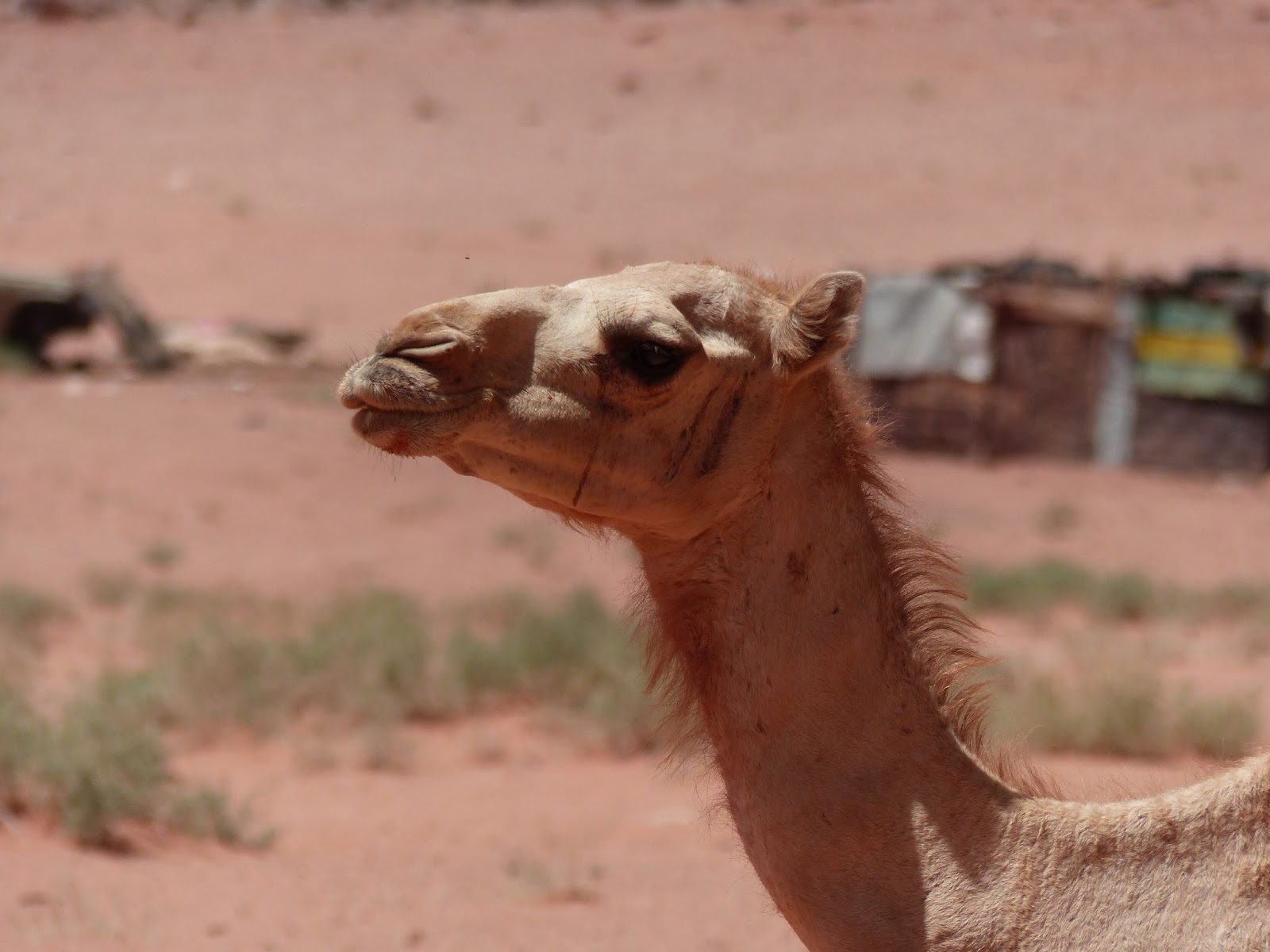
We spent the night at a Bedouin tent camp, and the following morning we went to Wadi Rum, a very large valley known for its geology and the presence of Lawrence of Arabia.  We also saw camels grazing in small figs.  They were friendly enough to allow some photographs.


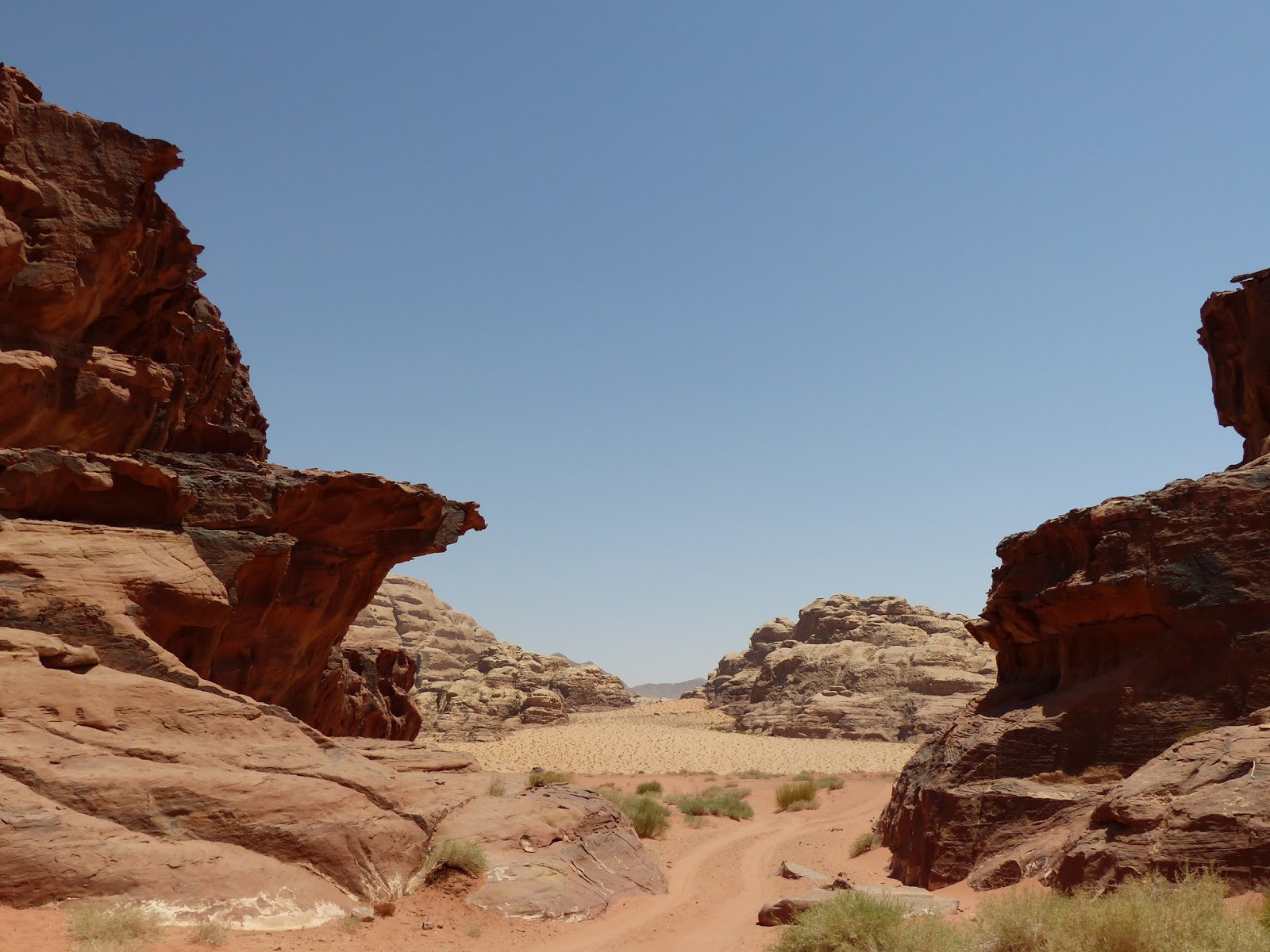
The all-wheel drive suburbans took us through the shifting sands and dunes of Wadi Rum.  The surrounding sandstones were interestingly weathered and varied in color, giving a hint that their origins varied slightly to produce mosaics of reds and yellows.

We returned to Eilat from Wadi Rum after a brief but packed weekend.

Wednesday, August 26, 2015

Poems About IRES Projects

Inspiration for art can come form the weirdest places

A Haiku About Nitrate Isotopes (Joe's Project)
By Kyle

Joe came and sampled
For two days out of sixty

More work is ahead


A Sonnet About Collecting Tissue Samples From Corals (Ana's Project)
by Alanna

Oh corals that I smell
Little white and porous blocks
Like little birds within your flocks
On the table do you dwell
Knowing not you soon face hell
The airbrush awaits and soon knocks
Away falls your tissue like golden locks
Why your little bodies we destroy?
To study the genes of your tulips
And publish the findings in a journal
For the science we employ
The sacrificial polyps

Despite the methods most infernal


A Limerik About Groundwater Sampling (Alanna's Project)
by Kyle

Oh pit on the beach you're a crater
You took days of hot sweat and hard labor
But now it is done
It was all in good fun
The results could not have been greater


A Pontoon About Uranium Dating (Kyle's Project)
by Alanna

For Uranium, Thorium, Lead
To know the dates I need
238, 234, 210
The estuarine sediment

To know the dates I need
clean, Clean, CLEAN!
The estuarine sediment
Off to the Neptune do you go

clean, Clean, CLEAN!
For Uranium, Thorium, Lead
Off to the Neptune do you go
238, 234, 210


A Freeform Poem About Pb Isotopes (Chia-Te's Project)
by Joe (with a lot of help from Kyle and Alanna)

There's dust in the air I swear
Says the man whose skin is fair
We're not sure why it's there
Maybe we should be aware
Where all this lead is coming from?

Thursday, August 20, 2015

Don't panic! We can correct for organics.

My lagoon sediments are rife with living creatures.  Bacteria, protists, algae, and sea grass live on top of, or down in, the sediments.  At the bottom of my carbonate sediment cores, the lagoon muds turn into organic rich peat left over from a vegetated area that flooded with seawater and drown.  If left over tens of millions of years, compressed and gently heated, this peat layer would turn into a coal seam.

At present, they are only about 5,000 years old and could cause some problems in interpreting the uranium/thorium ages I have spent the summer working on.  Carbon-rich sediments act like a sponge - they are good at absorbing uranium out of seawater and holding on to it.  If they begin with excess uranium, they will appear to have less thorium which occurs after uranium decays.  The result is an artificially young age.

Problems like this arise all the time in earth science because nature is typically not a closed system.  Different cycles and processes interact with one another and result in a signal that is smeared.  It is for this reason many experiments and data sets require long periods of observation or replicates (or triplicates, etc.) with the idea that more data will give a consistent average value which is the closest "true" value of a process.

Anyway, I digress.  In the case of my muds, I need to know how much organic content exists so I can correct for any absorption of excess uranium they might cause.  To do that, I essentially set them on fire.  First I way out a few dozen milligrams of my carbonate material and place them in glass wells.  I also weigh some standards (material we know the organic content of very well and compare it to the unknown samples).

My sample wells.
A close up of samples.  The dark samples are organic-rich carbonate mud.  The orange is a plankton standard.

I add hydrochloric acid to each of the wells to dissolve away the carbonate (the top left plate is already done in the image above).  Carbonate has carbon (it's in the name) in the form of CaCO3.  If I were to measure the pure sediments, I would get an overwhelming signal of carbonate.  By adding acid, the carbonate reacts to produce water and carbon dioxide gas which fizzes out of my sample.  This is good because now the carbonate carbon has left in the form of a gas, and the residual material is mostly unaffected by the acid.  I can dry the sample, collect my organic carbon residue, and stuff it into little tin capsules.  I compress these into little discs, and they are ready for measurement.

Tin capsules, a holding cell, and a stylus I use to compress them.
Once compressed, I can open the hold cell to get the disc.
Here is a before and after of a compressed tin capsule.
Now the samples are held in a container until it is time to ignite them.
By incinerating the tin capsule and measuring the carbon coming off of it, I can determine how much organic carbon was there compared the original mass of my mud.  This will give me a percentage (say, 2 or 3%).  I would use this value to then correct any oddities I see in my uranium data to help reconstruct the age of my sediment cores.  This extra step gives me more confidence that my ages are correct, and then I can move on to reconstructing the lagoonal environments that existed at those points in time in the past.

Tuesday, August 11, 2015

Jerusalem: The Old City

Dome of the Rock
The buff colored stone streets are slick.  Smoothed and shined from over 4,000 years of people walking, running, laughing, playing, fighting, shopping, dancing, dying—Jerusalem is a city of history quite unlike any I have experienced.  It is among the oldest continuously inhabited cities in the world, with much of the modern layout existing in one form or another for 4,000 years with other evidence of habitation over 2,000 years before that.

Modern civilization stems from the simple act of placing seeds and plants into the ground.  Over 7,000 years ago we learned to farm.  This city was here.  Came and went the the millennia, revolution after revolution—political, industrial, technological—and this city was here.

The Austrian Hospice
We stayed in the Austrian Hospice situated in the Muslim Quarter of the Old City, the ancient, walled square kilometer of masonry upon masonry through which Jesus, the Apostles, the Romans, the ancient Hebrew people, walked and wandered.  A mosque across the street called Muslims to prayer at 4:30 in the morning, the sun itself barely awake.  We were swept up in the foot traffic, streets packed wall to wall with pedestrians as the occasional car tried to squeeze its way through.

Our time in Jerusalem was spent mostly looking at the religious history of the city, for history and religion are inexorably intertwined here.  We started off at the Holocaust Museum in the far eastern part of the newer Jerusalem built beyond the walls.  It is an incredibly well-constructed museum and display of arguably the most traumatic event in recent Jewish history.

The Place of Ascension, Mount of Olives
The next bit of our time consisted of going to all of the holy sites of three of the major religions, Christianity, Judaism, and Islam.  These included places such as the Mount of Olives where Jesus is said to have ascended to heaven, with views of the Temple Mount (Dome of the Rock, currently a mosque), the room of the Last Supper, and the Via Dolorosa (way of sadness) along which Jesus walked with the cross.

Reconstructed Room of the Last Supper

View post on imgur.com

Our second day in Jerusalem was spent learning of conquest and fall of Jerusalem to a host of cultures, including Romans, Byzantians, Arabs, and later western powers (Britain primarily) over the last 2,000 years that have created the backdrop for the creation of Israel, the Israel-Palestinian conflict, and the modern city of Jerusalem.

Thursday, July 30, 2015

Snow White and the 16 Columns

In Santa Cruz, I live in a beach town.  In Eilat, I work in a beach town.  In both places, I spend a good deal of my time in the lab.  There are labs, and then there are clean labs.  The difference?  Well, apart from clean being just what they are (clean), they stay that way by following a laundry list of procedures to keep dust, hair, and lint out of samples (which destroys the data).

In the case of the cleans labs at Santa Cruz and IUI, the main cause of concern is metal.  These labs focus on trace metal chemistry meaning that the scientists are studying tiny, tiny, tiny amounts of material containing things like lead, uranium, and thorium.  These can exist as minute quantities in many things we use in our daily lives such as steel doors, brass handles, pipes and wires, and electronics.  Because of this, clean labs tend to be made almost entirely of plastic.

In addition, the protective equipment I must wear in the lab has two purposes.  It keeps lint from my clothes or hair from my head  from floating around the lab and contaminating the space, and it protects me from the many types of acid used to study metals.  In this picture, I'm wearing a hair net, gloves, and a Tyvek suite which keeps my clothes and body from contaminating samples.


I do all of my work wearing this outfit.  As I said, clean labs mostly use plastic, and one of the stars among the plastic world is Teflon.  Yep, Teflon, the non-stick coating with which you may be familiar.  It's quite a dense plastic, and the non-stick properties are useful when dealing with drops of liquid like those falling out of these columns.


As I add nitric acid to the top of the columns, it slowly drains through the resin and strips out metals I don't want.  I can then use another acid, like hydrochloric acid or bromic acid, to take out the thorium and uranium.  If the columns weren't made of Teflon, the tension of the water would cause the drops to stick, and I would never get my sample!



Once I have collected the drops in Teflon beakers, I place them on a hotplate to evaporate most of the liquid.  All that remains is a tiny, tiny pinpoint of solid that contains my concentrated uranium or thorium.  These are the samples I will analyze on a mass spectrometer, an instrument that uses magnets to detect the mass (amount of stuff) in a sample.  Remember that every element on the periodic table has a different mass, and each element actually has different varieties, called isotopes, that differ slightly in mass because of the number of neutrons in their nucleus.  The magnets affect each mass differently, so when they hit the detector, the instrument knows what it is based on how it traveled through the magnetic field.

Mass spectrometers have revolutionized science, and in particular the earth sciences.  They tell me what kind of stuff I'm looking at, and based on the known physical properties of that stuff (like uranium), I can deduce much about the history of a material.  Geology is storytelling, and the clean lab offers an exquisite set of tools to read that story.

Monday, July 27, 2015

Red Sea Geology

Being a group of mostly geologists, we tend to notice the rocks around us.  Rocks are the pages of history we read to tell the Earth story; the story of the Gulf of Aqaba and the Red Sea is in the midst of an exciting chapter.

There are three dominant rock types in this region: granite, sandstone, and limestone.  You can see them in this picture from Timna when we visited.


The granites are the dark rocks on the left.  The sandstone and limestone beds are the lighter colored rocks on the right in the background.  The granites are about 630 million years old (about 1/7 the age of the earth).  They formed as magma slowly rose from the mantle and cooled slowly under the crust.  Over millions of years, that crust eroded away to expose them, and erosion continued on these crystalline blobs to produce flat land much like the topography of Australia.  This is called the peneplain.


Notice how the red line skims just the tops of these granite mountains in Jordan just across the gulf from our apartment.  These granite rocks are extensive and can be seen from space.


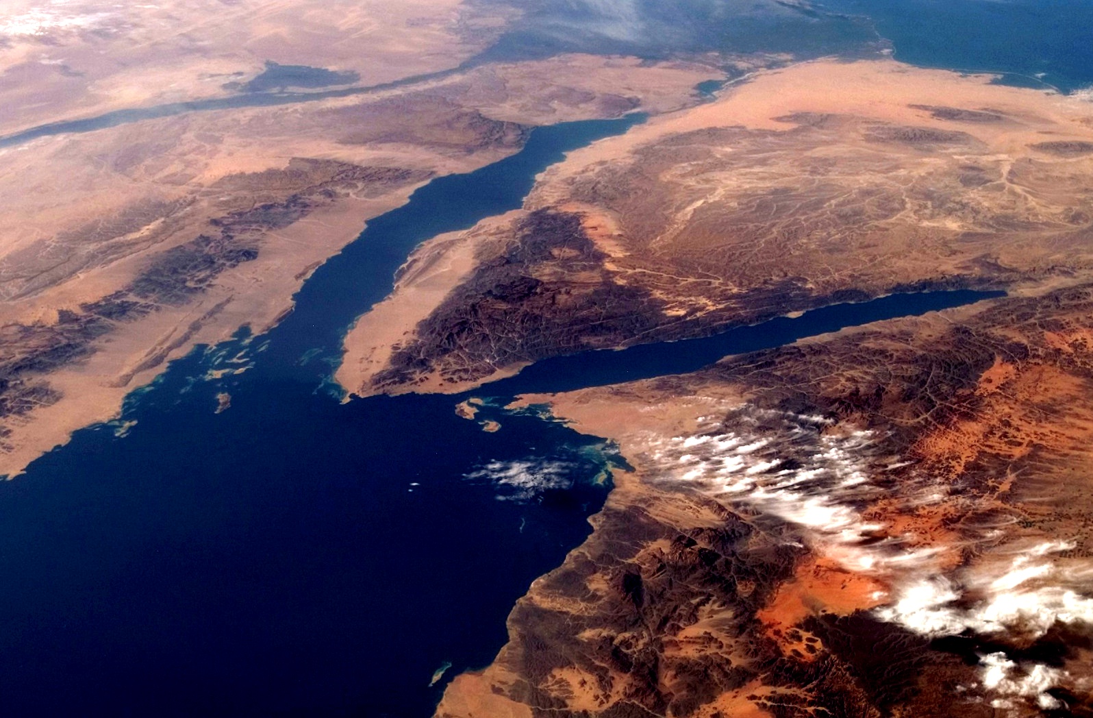
This picture of the Sinai Peninsula from Wikipedia shows the granites and sandstones.  Egypt is to the left of the Gulf of Suez (left fork) and Eilat is at the tip of the Gulf of Aqaba (right fork).  The dark rocks around the gulfs are the granites, and the lighter tan colors are the sandstones and limestones.

 The sandstones and limestones indicate a shallow sea and coastal environment.  These have been deposited over the last 500 million years or so.  When sea level rises, limestones are deposited, and when it falls, sands encroach over the limestones, eventually hardening to form the sandstone.  This produced the rock types seen here.


The story continues, however, with the start of East African Rift system about 25 million years ago.  Convection from the mantle is slowly pushing up on the eastern side of Africa.  As the heat spreads side ways, it pulls the continent in three directions and causes it to tear (called a triple junction).  This is the same process that rifted Pangaea apart 175 million years ago.  As the continent rifts, deep valleys open up and get flooded with seawater; this created the Gulf of Aden, the Red Sea, and, farther north, the Gulf of Aqaba.  The process is still continuing, and 200 million years in the future this region will be on the edge of an ocean as vast as the Atlantic.

Nature doesn't like holes, though, so it fills them.  Though the depression fills with seawater, the rocks themselves become unstable as the crust pulls apart.  They crack and sink downward to create large fault blocks.  Imagine a row of books slowly being pulled apart; those in the middle will slide to fill the space.

The sliding blocks create valleys and ridges (think of the Ridge and Valley province of Nevada).  In geology, these are called horsts (ridge) and grabens (valleys).  Younger rocks like the limestone and sandstone can slide downward and appear right beside old granites.  This results in a color banding from ridge to ridge.

Notice how the mountains behind the buildings on the left from from dark to light to dark to light.  The mountain peaks are split by these faults.  The process is still going on today.  About a week before we arrived, a relatively small 5.0 earthquake occurred as a block slide downward.  This will continue to happen until the coasts move far enough away from the ridge to become stable many millions of years in the future.